THE sustained high level of the flooded Murray River loses an uncertain threat to landholders in this area.
The duration of high levels – rather than the expected peak height – may weaken levees and aggravate the predicament already being faced by many rural residents.
Emergency Service officials do not expect Barham and Koondrook to be seriously threatened by the expected peak next week, but are concerned about the prospects of maintained high levels.
A warning of moderate rural flooding remains for the area around Barham, rising to a major flood level next week.
Kerang shire engineer, Mr Peter McDonald told a meeting of emergency service representatives on Wednesday that the district was in a state of preparedness, but stressed that Barham and Koondrook’s flood levees had coped with previous floods close to the expected peak and would be expected to do so again.
“Our main worry is that it’s going to hang on for a long time and may affect (rural) areas where weak spots show up”, he said.
Benjeroop farmer, Cr Brian Drummond said that most areas should co[e with the flooding, but said that some landholders had done no levee maintenance since the 1975 floods.
Cr Drummond said that many landholders in his area are alarmed about the possible consequences, but Rural Water Corporation and Victoria State Emergency Service officials are confident that most areas will cope.
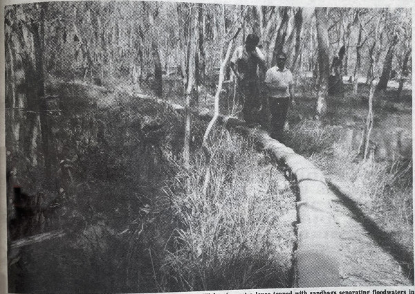
Victoria State Emergency Service, police and shire officials inspected levees at Koondrook, Myall, Murrabit and Benjeroop and Wednesday.
Filled sandbags have been stockpiled at Kerang, Koondrook and Barham and services are prepared to respond to any emergencies.
The Murray River height at Barham/Koondrook yesterday morning was steady at 6.03m and receding slowly. The Bureau of Meteorology predicts that the peak next week will be 6.15 m – 3 cm higher than the 1975 and 1956 floods.
The major flood peak at Echuca on Tuesday was 2cm higher than the 1975 flood.
Local emergency officials are concerned that publicity about the Echuca flood problems which were confined to low-lying areas, will lead new residents and visitors to erroneously believe that there is a “wall of water” approaching when the river actually spreads out throughout forests, tributaries and farmlands before reaching the area.
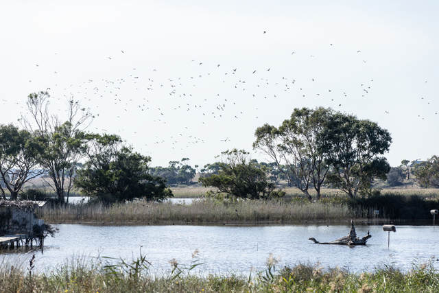
Landholders on the New South Wales side of Murrabit experienced record heights after the torrential rain almost a fortnight ago and thousands of hectares of remain inundated.
A minor flood peak on the Loddon River has passed Appin South, but is not expected to reach minor flood status at Kerang. Slowly receding water in the lower reaches will also ease the threat of water backing up from the Little Murray River and Murray River.
“We are prepared as well as we can be”, Mr McDonald said.
Weir lock gates open
THE lock chamber gates at Torrumbarry Weir were opened on Thursday to assist the passage of the high river flows in the Murray River.
While the gates are open and with the Weir Trestles still in place, navigation of the waterway would be extremely hazardous and presents a threat to both the vessels and the Weir structure. Accordingly, the passage of river vessels past Torrumbarry Weir will not be possible.
FLOODING INFORMATION
– Recorded information about flooding is available by calling Kerang 52 2307. Information is updated regularly.
– If urgent assistance is required, call 52 2266 and wait for the call to be diverted to the duty officer.
– Information is also available at Barham by calling 53 3200.