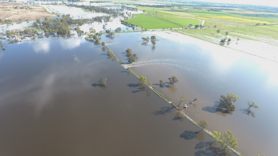
ANXIETY ran through the Kerang district overnight Monday as 27mm fell on the Loddon River, already at major flood levels.
The major level was expected to remain for a number of days as water meandered downstream to the Murray River, which was dealing with peaks from the Campaspe and Goulburn rivers upstream at Echuca.
Water entered about 20 houses after the western bank of the Loddon was breached on Saturday.
Major roads between Kerang and Cohuna and Kerang and Koondrook have been cut off as the Pyramid Creek and Nine Mile Creek spilled on to roadways. Flash flooding caused more headaches for emergency services.
There were concerns about flooding around Cohuna, but that had been downgraded as any floodwater from the Murray at Torrumbarry would flow towards Kow Swamp, near Leitchville.
The Loddon River at Appin South peaked at 3.47m on Friday morning, while the Murray Valley Highway bridge in Kerang peaked at 77.97m Australian Height Datum on Saturday morning.
On Monday afternoon it was at 77.84m AHD and steady, with major flooding. Major flood level is 77.80m.
The January 2011 flood measured 78.03m on the Murray Valley Highway river gauge.
Much of the lower Loddon area was awaiting with bated breath what damage the major peak could inflict on Benjeroop and Murrabit West properties.
Murrabit West resident Peter Heffer said he had been working "flat out" to get a levee bank "nice and high" around his Murrabit West Road-facing house.
"I've put the banks up nice and high and sandbagged ... trying to be organised."
Mr Heffer, who has lived in the same location for 12 years, said his property "just missed out on being flooded", helped by being on the Murray River side of the road.
"I got myself early on to it in preparing the levee and most around here have been as well," he said.
"What happens will all depend if banks blow out or not. Hopefully they won't, but I'm just preparing for the worst.
"There is some water at Benjeroop that has backed up, so if that blows we need to be as ready as can be."
Mr Heffer admitted anxious feelings, but his son was "excited" by the experience.
"It's just a waiting game."
He said he had gone through multiple cans of mosquito repellant in the past week.
Toni-Lee Kelly, who lives in Murrabit West, was relieved on Sunday morning after learning her brother's house, opposite the power station in Kerang, had been spared inundation.
"His bank held out," she told the Gannawarra Times.
Her house, off Murrabit West Road, went under in the 2011 floods, but a levee bank has since been built around it.
"The Loddon doesn’t concern me as much as the rise we are expecting from the Murray," she said.
"The water has nowhere to flow like it did in 2011.
"I’m using the levels in Kerang as a reference as to when we should expect the water downstream.
"I’ve also been messaging our neighbours who live directly on the Loddon River behind the property we are on.
"The Kerang floods Facebook page has been absolutely amazing in keeping people up to date as to where the water is at and what it’s doing."
Ms Kelly said it was "literally just a waiting game now".
"If it’s looking like getting too high, we will evacuate as we have six kids.
"I witnessed the 2011 floods and how hard and fast the water came in around this area (wasn’t living here at the time but my in-laws were)."
As the Loddon system caused heartbreak, moderate flooding was slowly easing along the Avoca River downstream of Charlton at Quambatook, where the river level peaked below the major flood level on Friday afternoon.
The Avoca River at Quambatook peaked at 2.36m Friday afternoon.


